


Published : 25 Jun 2013, 02:42 PM
Updated : 23 Apr 2022, 05:37 PM


The increased water pressure has endangered a seven-kilometre stretch of two polders -- a low-lying tract of land enclosed by embankments – of Bagerhat Water Development Board (WDB).
Its Executive Engineer Md Khalilur Rahman said Bhairab, Panguchhi and Baleswar rivers have swelled by up to four feet, flooding areas in and around Bagerhat town.
Two polders under Rampal, Sharankhola, Morelganj, and Sadar Upazila face the maximum risks.
Of these, the four-kilometre polder number 35/1 needs to be heightened by four metres and the three-kilometre stretch of polder number 35/3 by one metre, according to officials.
WDB engineers fear these embankments can give in to water pressure any moment inundating villages under the four Upazilas.
bdnews24.com’s Bagerhat Correspondent said the town's main street, Old Post Office, Daak Bungalow Ghat, Launch Ghat, Rahater More, Kazi Nazrul Islam Road, Basabati, Nagerbazar and Hadikhali are under water.
Hundreds of houses under Sadar Upazila's Kadapara have been flooded. The low-lying area is currently waterlogged.
'Manojit', a resident of Maria Palli, said the whole area went under water during high tides in the Bhairab River.
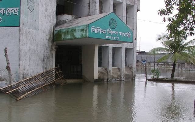
High tide over the past two days inundated the streets in the Bangladesh Small and Cottage Industries Corporation (BSCIC) industrial area.
Its Acting Deputy Manager for Bagerhat, Hazra Siddiqur Rahman, said the factories in the industrial belt had not been flooded but the streets suffered the most damages.







