Published : 02 Sep 2021, 11:02 PM
Updated : 08 Apr 2022, 01:10 PM


At least 14 people died as waters rose in basements. A tornado in southern New Jersey levelled a stretch of houses. Some drivers have reportedly been stranded since Wednesday night, more than 200,000 homes in New York, New Jersey and Pennsylvania remain without power, and states of emergency have been declared across the region.
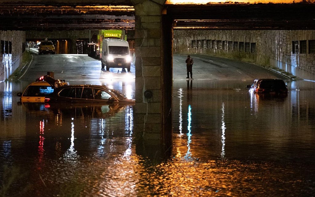
The rain Wednesday — more than half a foot in just a few hours — turned streets and subway platforms into rivers and sent emergency responders in boats rescuing people from the rooftops of cars and from flooded homes. Hundreds of people on trains and subways were evacuated.
The rain broke records set just 11 days before by Tropical Storm Henri, underscoring warnings from climate scientists that the storms herald a new normal on a warmed planet where hotter air holds more water and allows storms to gather strength more quickly and grow ever larger.
Though skies are clearing, more than a dozen of the city’s subway lines remain at least partly suspended, along with commuter rail service across the region. Airports were open, but hundreds of flights were cancelled. Rescues continued Thursday morning, and some rivers in New Jersey and Pennsylvania were still rising.
In New York City, the dead ranged in age from a 2-year-old boy to an 86-year-old woman, police said. Some drowned in basement apartments in Queens, where a system of makeshift and mostly illegally converted living spaces has sprung up.
Five people were found dead in an apartment complex in Elizabeth, New Jersey, city officials said Thursday. Another death occurred in Passaic, New Jersey, where the Passaic River breached its banks and fish flopped in the streets.
The 3.15 inches of rain that fell in Central Park in one hour Wednesday eclipsed the record-breaking one-hour rainfall of 1.94 inches on Aug. 21. The National Weather Service, struggling to depict the level of danger, declared a flash flood emergency in New York City for the first time.
In Bergen County, New Jersey’s most populous county, County Executive James Tedesco, a former firefighter, said Thursday, “We have not complete devastation but close to it. This is as bad as I’ve ever seen it.”
The remnants of Ida swept across parts of southern New England on Thursday.
As of 5 a.m. Thursday, the system was located near eastern Long Island, New York, moving northeast at 28 mph and accelerating toward Cape Cod, Massachusetts, with maximum sustained winds of 28 mph.
After heavy rain overnight, more rain was expected across parts of Connecticut, Massachusetts and Rhode Island, where flash flood warnings were in effect, the weather service said.
“This will bring the potential for rare high impact type of flooding to southern New England,” the weather service said.
The rain had already caused flash flooding of “small creeks and streams, urban areas, highways, streets and underpasses as well as other poor drainage and low-lying areas,” according to the weather service.
Although the rainfall was beginning to move out of the area, there were still many flooded roads throughout southern New England.
“It will take time for the water to recede in these areas,’’ the Weather Service in Boston said. “Do not attempt to cross any flooded roads this morning. Turn around don’t drown!”
Rhode Island has already seen two tropical storms make landfall this hurricane season: Henri last month, and Elsa in July.
© 2021 The New York Times Company