Published : 05 Jan 2018, 11:28 PM
Updated : 19 Oct 2022, 02:04 PM


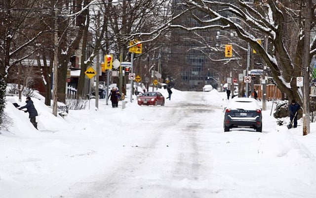
In less than two weeks since the winter set in, the low temperature has smashed a series of old records, forcing authorities to cancel New Year outdoor events and take precautions for a harsher winter including opening shelters for the homeless people.
A 67-year old minimum temperature record was broken in Toronto on Dec 28 when the mercury dropped to -22 degrees Celsius. The previous record was -19.9 degrees Celsius in 1960.
Officially, the winter season began in Canada on Dec 21.
On the New Year’s Eve in southern Alberta, Lethbridge hit a record low of –38.5 degrees Celsius, beating the previous record of –36.4 C set in 1992, according to Environment Canada.
Weather records have been kept there since 1886.
It was even colder in nearby Claresholm, another town in southern Alberta, where a new record of –41.8 degrees Celsius blew away the record of –35.6 degrees Celsius, which was set in 1964.
Ontarians were shivering as well on the day too. Toronto's Pearson airport saw a record-setting low of –22.6 degrees Celsius, with the previous record of –21.1 degrees Celsius set in 1968.
At the Ottawa International Airport, the temperature dropped to –28.6 degrees Celsius, beating the 71-year-old record of –27.2 degrees Celsius.
According to Environment Canada, winter was mild in 2017 and it was the seventh warmest winter in 70 years.
The government environment agency said an Arctic air mass brought extreme cold to a wide swath over much of Canada prompting many cities to alter their New Year's Eve celebrations.
Since then, many cities have been put under 'extreme cold warning' as temperature kept plummeting, causing snow, windchill and snowstorms. Provinces in Atlantic Canada – Nova Scotia and New Brunswick –were battered by the snowstorm on Thursday along with some US cities.
The Environment Canada issued a fresh extended 'extreme cold warning' for Toronto beginning Thursday when the temperature would drop to -20 to -25 degrees Celsius with a real feel of -30 to -40 degrees Celsius.
The lowest temperature recorded in Toronto on Friday morning was -24 degrees with a windchill of -39. It was again a Jan 5 record as previous lowest temperature was recorded on the day at -20.6 in 1959.
The advisory will continue until Saturday.
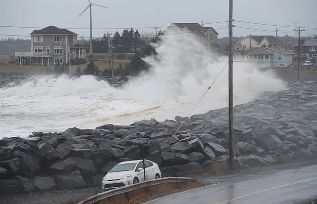
A storm surge from the Atlantic Ocean hits a break wall during Winter Storm Grayson in Cow Bay, Nova Scotia, Canada January 5, 2018. Reuters
Chris Scott, The Weather Network's chief meteorologist, said the message from his forecast team is "buckle up because it looks like a stormy winter".
Scott told CBC News this year's La Nina weather system bears a striking resemblance to that of 2007-2008 when Toronto recorded its snowiest winter ever.
"History tells us that when we have cooler waters off the coast of South America, that's La Nina, and those winters tend to be classic Canadian winters."
But, Dave Phillips, a senior climatologist at the Environment Canada, disagrees, pointing out that "this year's La Nina system is weak and won't pack the kind of punch seen in past years".
"It's almost as if global warming [and] climate change have kind of tempered the La Ninas and made them not as brutal as in the '50s, '60s, and '70s," he said in the CBC report.
Scott's forecast sees storms with a lot of snow in December but the winter conditions are expected to start in January.
He also expects "winter in Canada to linger, meaning snowstorms could continue into March".
But Phillips said despite calls for a "classic" Canadian winter wonderland, he does not see 2018 looking like the white seasons of memory.
"Our winters aren't what they used to be. Oldtimers are right, winters really have changed," he told CBC, adding that weather data reflects the trend.