


Published : 07 Sep 2026, 10:02 PM
Updated : 16 Sep 2026, 11:48 AM


Africa and Greenland can look surprisingly similar in size on the world map familiar to generations of schoolchildren.
They are anything but.
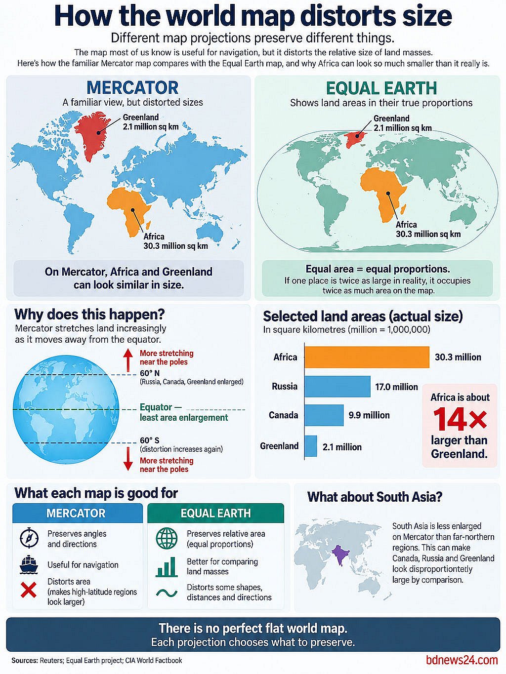
Africa is roughly 14 times larger than Greenland. Yet on the Mercator projection — one of the world’s most recognisable maps — Greenland is stretched so dramatically that the difference can be difficult to grasp.
Now the United Nations is backing a different way of showing the world.
The UN General Assembly voted overwhelmingly on Sept 4 for a resolution encouraging wider use of equal-area map projections, including Equal Earth, which preserve the relative sizes of continents and land masses.
The resolution passed with 164 votes in favour, six abstentions and only the United States opposed. It is not legally binding and does not ban the Mercator projection.
So just how distorted is the familiar world map, why does Africa appear so small on it, and does Equal Earth finally show the planet as it really is?
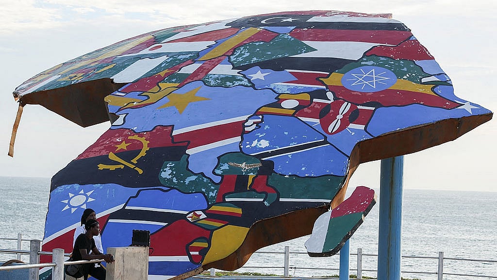
Is the Familiar World Map Actually Wrong?
Not exactly.
The Mercator projection was devised by Flemish cartographer Gerardus Mercator in 1569, primarily for navigation.
Its great advantage is that it preserves local angles and directions. A constant compass bearing can be plotted as a straight line — an enormously useful feature for sailors.
The trade-off is area.
Earth is curved and a conventional map is flat, so every map projection must distort something. Mercator increasingly enlarges land masses as they move farther from the equator.
That makes Greenland, Canada, Russia and northern Europe appear disproportionately large relative to regions closer to the equator, including Africa, South America and much of South Asia.
The UN resolution itself recognises that different projections suit different purposes and leaves Mercator’s established navigational role untouched.
The problem, then, is not that Mercator was badly designed.
It is that a projection created for navigation became a familiar general-purpose picture of the world, despite not being designed to compare the true sizes of continents.
Just How Distorted are the Sizes?
Greenland provides the clearest example.
On a Mercator world map, it can appear roughly comparable with Africa.
In reality, Africa is about 14 times larger.
The distortion becomes greater with latitude. Places around the equator undergo relatively little enlargement, while land masses closer to the poles are stretched increasingly.
That is why the effect goes beyond Africa. South America and South Asia appear smaller relative to northern regions than their true areas would suggest, while Canada, Russia and Greenland are enlarged.
Mercator therefore remains useful for showing direction, but gives a much poorer impression of how much land different regions actually occupy relative to one another.
What Does Equal Earth Do Differently?
The Equal Earth projection was developed in 2018 by cartographers Bojan Šavrič, Tom Patterson and Bernhard Jenny.
It is an equal-area projection. Put simply, if one region covers twice as much of Earth’s surface as another, it occupies twice as much area on the map.
That means Africa is shown at the correct scale relative to Greenland, while South America, India and other regions closer to the equator are likewise represented in proportion to northern countries.
Its designers also wanted continental shapes to remain relatively familiar. Equal Earth was created partly as an alternative to the Gall-Peters projection, another equal-area map whose elongated continents can look unfamiliar.
So Africa does not become “bigger” on Equal Earth.
It stops being shown disproportionately small.
Does Equal Earth Show the World Perfectly?
No, because no flat map can.
Equal Earth preserves area, but cannot simultaneously preserve every shape, distance and direction exactly as they appear on the globe.
That is why the UN resolution does not declare one projection universally “correct”. Several countries stressed during the debate that different maps remain appropriate for different uses.
India, which supported the resolution, also stressed that backing equal-area maps should not mean prescribing a single cartographic method or affecting questions of borders and sovereignty.
The real question is therefore not which flat map is perfect, but which kind of accuracy matters for what you are trying to show.
Why Has Africa Pushed for the Change?
African governments and campaigners argue that Mercator’s long-standing use as a general world map has shaped perceptions of Africa by making the continent appear smaller relative to northern regions.
The campaign is part of a broader effort led by Togo and backed by African states to encourage more proportional representations of the world.
Togo’s Foreign Minister Robert Dussey told the General Assembly that the initiative was about the proportional representation of continents, not borders or sovereignty. He also acknowledged Mercator’s historical usefulness for navigation.
Supporters say maps used in schools, media and public institutions can influence how people perceive the scale and importance of different regions.
Some have also linked the campaign to addressing colonial legacies. But there is an important distinction: Mercator was not devised in 1569 as a political project to make Europe look bigger. The criticism concerns its later adoption as a default general-purpose world map.
Will School Atlases and Google Maps Now Change?
Not automatically.
The UN resolution is non-binding, so it cannot force governments, publishers or technology companies to abandon Mercator.
Instead, it encourages wider use of maps that preserve relative land-mass sizes. Togo has said it plans to update school geography materials and push for broader adoption internationally.
The Equal Earth project also makes its wall maps available in the public domain, allowing them to be reproduced and modified freely.
Digital navigation is a different matter.
Mercator and related projections remain useful when users zoom into streets or plot routes. The Africa-Greenland size problem matters far more when the map is being used to show the whole planet and compare regions with one another.
Why Did the US Vote Against It?
The United States was the only country to vote against the resolution.
Reuters reported that Washington described the initiative as a “radical ideological project” and argued that the UN should focus on more pressing priorities.
Six countries abstained, with some delegations raising concerns about how disputed territories are depicted on particular Equal Earth map products.
Ukraine, for example, said it supported correcting distortions in the sizes of continents but objected to how some Equal Earth material represented Ukrainian territory occupied by Russia. Other governments stressed that the resolution had no bearing on sovereignty, borders or territorial claims.
So Which World Map is Actually ‘Right’?
That depends on what you want the map to tell you.
If the aim is to compare the true relative areas of continents and countries, an equal-area projection such as Equal Earth does something Mercator cannot.
If the aim is to preserve angles and directions for navigation, Mercator retains advantages of its own.
Neither can turn a globe into a flat surface without distortion.
The difference is what each chooses to distort.