Home
+
Published : 10 Jul 2026, 02:01 PM
The Bangladesh Meteorological Department (BMD) says the well-marked low-pressure system over northwestern Madhya Pradesh and adjoining areas in India has weakened into a low-pressure area.
Meteorologist Kazi Jebunnesa, however, said rainfall across the country is likely to continue until Monday.
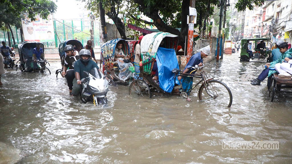
Continuous rain has fallen in Dhaka since late Thursday night. Speaking to bdnews24.com on Friday afternoon, Jebunnesa said rainfall in the capital had remained relatively light despite the persistent showers.
From 6am on Thursday to 6am on Friday, Dhaka received 28mm of rain, followed by another 15mm between 6am and 9am.
She said Chattogram had recorded the highest rainfall in the country.
Asked how long the rain might continue, Jebunnesa said the current pattern was likely to persist until Jul 13, after which rainfall may gradually ease.
She said the low-pressure system, now over land, was weakening and would eventually dissipate completely. The warning signal was likely to remain in force for another two to three days.
Meanwhile, the BMD, in its latest weather bulletin issued on Friday morning, said the low-pressure area was centred over central Uttar Pradesh and adjoining areas and was expected to weaken further.
A strong pressure gradient persists over the northern Bay of Bengal and adjoining areas.
As a result, squally winds may sweep across the seaports, the northern Bay and coastal areas of Bangladesh.
Accordingly, the Met Office has kept Local Warning Signal No. 3 in force for the seaports of Chattogram, Cox's Bazar, Mongla, and Payra.
All fishing boats and trawlers operating in the northern Bay of Bengal have also been advised to remain close to the coast and navigate cautiously until further notice.
In a separate heavy rainfall advisory, it warned that due to active monsoon conditions, heavy to very heavy rainfall may occur in parts of the Rangpur, Rajshahi, Mymensingh, Dhaka, Khulna, Barishal, Chattogram, and Sylhet divisions during the 24 hours from 10am on Friday.
The department also warned that such rainfall could temporarily cause waterlogging in parts of Dhaka and Chattogram metropolitan areas and trigger landslides in hilly areas of the Chattogram Division.
According to the regular weather bulletin issued Friday morning, the monsoon trough extends from Punjab and Haryana, through the center of the low-pressure area, Bihar, West Bengal, central Bangladesh, and onward to Assam. An extension of the trough reaches into the northern Bay of Bengal.
The monsoon remains active over Bangladesh and fairly strong over the northern Bay of Bengal.
As a result, during the 24 hours from 9am on Friday, most areas of the Rangpur, Rajshahi, Dhaka, Mymensingh, Khulna, Barishal, Chattogram, and Sylhet divisions may experience temporary gusty winds accompanied by light to moderate rain or thundershowers.
Also, some areas across the country may receive moderately heavy to very heavy rainfall.
Daytime and nighttime temperatures are expected to remain nearly unchanged nationwide during this period.
During the 24 hours ending at 9am on Friday:
The highest rainfall was recorded in Chattogram, with 211mm.
Other notable rainfall totals as follows:
Satkhira: 179 mm, Gopalganj: 163 mm, Ambagan: 153 mm,
Tarash: 138 mm, and Tangail: 124 mm.
Rainfall of varying intensity was recorded across the country.
The highest temperature was recorded in Faridpur at 33.4°C, while the lowest temperature was 23.7°C in Sylhet.
5 Rivers Flow Above Danger Level
Meanwhile, due to heavy rainfall and upstream runoff from the hills, water levels in five rivers have risen above the danger level at nine monitoring stations, while several other rivers are flowing near the warning level.
According to the Flood Forecasting and Warning Centre (FFWC) of the Bangladesh Water Development Board (BWDB), as of 9am Friday, the Sangu River was flowing 95cm above the danger level at Bandarban and 23cm above at Dohazari in Chattogram.
The Matamuhuri River was flowing 47cm above the danger level at Lama in Bandarban and 32cm above at Chiringa in Cox's Bazar.
The Kushiyara River was flowing 18cm above the danger level at Markuli in Sunamganj and 10cm above at Fenchuganj in Sylhet.
The Manu River was flowing 35cm above the danger level at the Manu Rail Bridge station and 80 cm above at Moulvibazar.
Finally, the Khowai River was flowing 60cm above the danger level at Balla in Habiganj.
The FFWC also reported that several rivers were flowing at or near the warning level as of 9am, including Teesta River at Dalia (Nilphamari), Kaunia (Lalmonirhat), and Tarapur (Gaibandha), Kushiyara River at Sherpur (Moulvibazar) and Surma River at Kanaighat (Sylhet), Chhatak (Sunamganj), and Sunamganj stations. Also, Someshwari River was flowing near the warning level at Kalmakanda (Netrokona) and Chhoto Feni River at Companiganj (Noakhali).
These observations indicate an increased risk of flooding in several regions as persistent rainfall continues across the country.